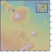
Crater
Location: central Libya, northern Africa
Latitude: 24° 55' N
Longitude: 17° 40' E
Image Width: 80 km (50 miles)
Data: Shuttle Radar Topographic Mission (SRTM)
Description: This image is the Wau en Namus volcano in the middle of the Sahara desert of south-central Libya. Three small salt lakes on the floor of the caldera have contributed to the name, which means 'oasis of mosquitoes'. The cone is about 500 m high, 4km in diameter, and surrounded by an apron of black volcanic ash 5-10km wide. There are several websites showing photos of this remarkable spot. Another volcanic structure is visible to the northwest. |
|
Dome
Location: Maur Adrar Desert, central Mauritania, Africa
Latitude: 21° 04' N
Longitude: 11° 22' W
Image Width: 80 km (50 miles)
Data: Shuttle Radar Topographic Mission (SRTM)
Description: This image depicts a bullseye structure, the Richat structure, in Mauritania. It was first noticed by space shuttle crews because of its prominent multiple ring features. The structure has a diameter of almost 50 km and was initially interpreted as an impact crater (a feature formed by the impact of a meteorite with Earth). However, so far no evidence has been found to support this interpretation (shock features or any other evidence). It is now believed to have been formed by the erosion of a symmetrical uplift of rock layers including limestone, dolomite, sandstone, mudstone and chert and therefore is often called the Richat dome. Notice the sand dunes of the desert encroaching from the south. |
|
Geology
Location: Southwest Algeria, Africa
Latitude: 26° N
Longitude: 2° W
Image Width: 160 km (100 miles)
Data: Shuttle Radar Topographic Mission (SRTM)
Description: The relatively flat-lying rock layers are highlighted by erosion, possibly caused by wind-blown sand from the nearby Sahara desert. |
|


